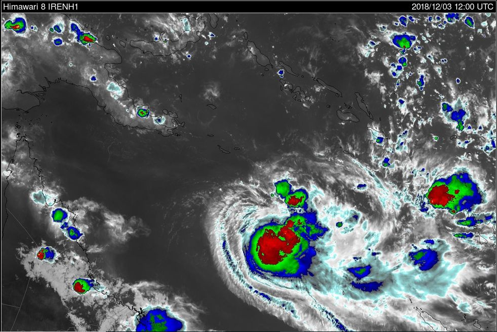
Brisbane, AUS-Australia officially started it’s cyclone season on November 1st 2018. However despite the bushfires in Queensland and flooding in Sydney and the wettest November for both Sydney and Melbourne a new weather threat is making it’s appearance. A Tropical Low (INVEST 97P) is currently situated in the Solomon Islands and will move S/SW over the coming days while it slowly develops into a tropical storm/cyclone. At the moment all models apart from the German (ICON/DE) has the low developing in the next 72 hours before tracking S/SW into the Coral Sea. Where it goes from there is still very up in the air and unpredictable.
Tropical Cyclone Owen (aka 05P) formed and was named by the BoM and JTWC (Joint Typhoon Warning Center). After satellite signatures observed late yesterday afternoon suggested it had reached a Cat 1 strength (Tropical storm for those in the Northern Hemisphere), and was noted and been moving slowly in a south/souteastwards movement. Most Models have indicated this and show that a track to the south/southwest is likely over the coming hours followed by a track to the west and northwest over the coming days. A note to this is a track to the southeast is also possible in the coming 12 hours as a High Pressure Ridge moves in from the south and may influence it and steer it away from Queensland for a short period and will also influence it to weaken the system over the coming 48-72hrs back to a tropical low status due to an increase of upper vertical wind shear (VWS). Beyond this we see some differences among models and can’t really give a precise answer to where or what the LOW will do. At this stage any impact on the coast of Queensland would see HEAVY RAINFALL and DAMAGING WINDS and a likely at tropical LOW intensity.
Over the coming hours a upgrade to a category 2 is likely and will be short-lived for 12-36 hours before it weakens eventually below cyclone strength in the coming 72 hours.
UPDATE Darwin & Brisbane, AUS-Ex-Tropical Cyclone Owen made landfall near Port Douglas the other day bringing HEAVY RAINFALL of up to around 250mm to the area and has now continued to cross the base of the York Peninsula before ending up in the Gulf of Carpenteria where she is now likely to form into a Cat 1 in the coming hours and develop into a Severe tropical cyclone Category 3 in the next 24-48hrs. She is then forecasted to continue to move westwards before making a U-turn back towards the QLD York Peninsula Coast (Eastern Side) and is likely to make landfall as a Category 3 Severe Tropical Cyclone either during Friday/Saturday.
Rainfall Totals the past few days where as follows:
Stay up to date as we continue to bring more news on Tropical Cyclone Owen as he strengthens in the Gulf of Carpentaria.
We will provide more detail as it comes to hand.
More to come. This is a developing story and more information will be released as it comes to hand.