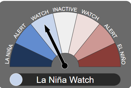
 Headlines: LA NINA WATCH CONTINUES as chances decrease for a La Nina overall, weak LA Nina possible by Summer.
Discussion: The latest on the Nino 3.4 region in the western tropical pacific is that there is now a 10-15% chance of a LA NINA of weak intensity which may develop in the summer period (November-December). Therefore a LA NINA WATCH continues.
In the last fortnight indicators have shown continued COOLING of the tropical pacific ocean at around 50-100m below the surface as cooler water continues to up dwell to the surface. However has lost the intensity over the past several months. The latest SOI (Southern Oscillation Index) shows currently neutral conditions. With all factors for a LA NINA WATCH continuing to be met until one of the current 3 surveyed international model the BoM surveys drops below the LA NINA Threshold in terms of a forecast for a LA NINA. The forecasts are currently considered HIGH confidence up and until 4 months ahead at this time of year.
The current NINO 3.4 state of play sees the majority of the surveyed International Models indicating a neutral/INACTIVE thresholds throughout much of the first month of spring, before 3 of the 7 surveyed international models have a LA NINA reaching the -0.8c threshold and peaking in either November or December before weakening into the new year (2025).
So what is the current State of Play: LA NINA WATCH:
- Current climate state: ENSO phase is currently neutral or declining El Niño. ✔
-
- Either:
SOI analogues: Of the 10 years that most closely resemble the current Southern Oscillation Index pattern, 4 or more have shown La Niña characteristics. - Or:
Sub-surface: Significant sub-surface cooling has been observed in the western or central equatorial Pacific Ocean.✔
- Either:
- Models: One-third or more of surveyed climate models show sustained cooling to at least 0.8 °C below average in the NINO3 or NINO3.4 regions of the Pacific Ocean by late winter or spring. ✔
So what is needed for a LA NINA ALERT to be issued? Below is a checklist of factors that must be satisfied before the Bureau will issue an alert for a LA NINA event in the tropical western pacific ocean:
Any three of the following criteria need to be satisfied for a LA NINA ALERT to be issued:
- Sea surface temperature: A clear cooling trend has been observed in the NINO3 or NINO3.4 regions of the Pacific Ocean during the past three to six months. ✔
- Winds: Trade winds have been stronger than average in the western or central equatorial Pacific Ocean during any two of the last three months. ✔
- SOI: The two-month average Southern Oscillation Index is +7 or higher. ❌
- Models: A majority of surveyed climate models show sustained cooling to at least -0.8 °C below average in the NINO3 or NINO3.4 regions of the Pacific Ocean by the late winter or spring.❌
All four of the following criteria need to be satisfied for a LA NINA to be DECLARED and issued:
- Sea surface temperature: Temperatures in the NINO3 or NINO3.4 regions of the Pacific Ocean are 0.8 °C cooler than average.

- Winds: Trade winds have been stronger than average in the western or central equatorial Pacific Ocean during any three of the last four months.
- SOI: The three-month average SOI is +7 or higher. ❌
- Models: A majority of surveyed climate models show sustained cooling to at least 0.8 °C below average in the NINO3 or NINO3.4 regions of the Pacific Ocean until the end of the year.
 =Criteria MET.
=Criteria NOT MET.
International Models:
Out of all the international models three of the seven (3 of 7) show a chance of a La Nina forming by at least August, been the UKMET, NOAA and the CAN-SIPS which means we have already met one of the criteria under models to issue a LA NINA WATCH phase.


Other International Models:


Climate Picture Update:


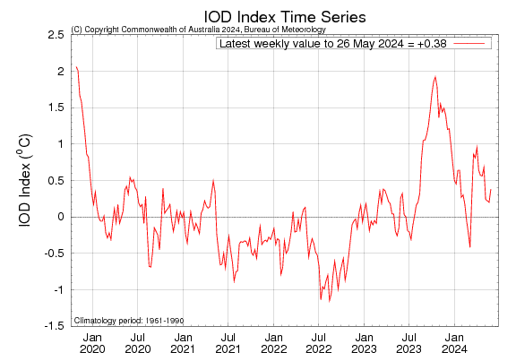
IOD (Indian Ocean Dipole):
On the other side in the Indian Ocean a Positive IOD is likely to peak in July before waning rapidly into neutral territory by Spring. This will see average-above average rainfall to set in across parts of Southern and Southeastern Australia as we head into winter and spring.
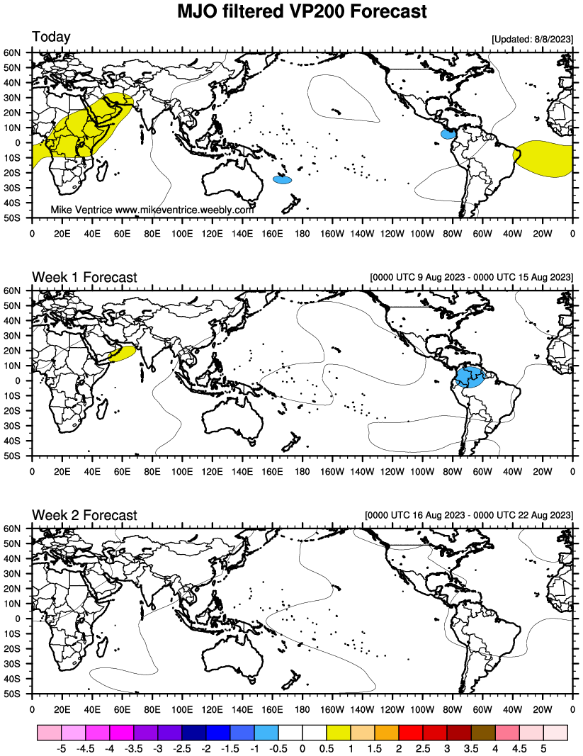
MJO (Madden Julian-Oscillation):
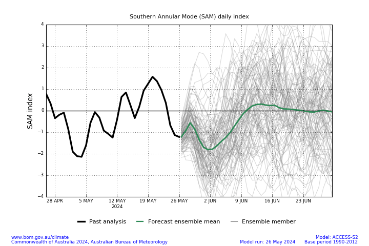
SAM (Southern Annular Mode):
Issued: 25th June 2019. Next Update: 9th July 2019.