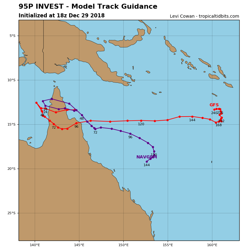
Brisbane, AUS, The first lot of 4 tropical lows are likely to develop over the Gulf of Carpentaria on Monday with another two likely to develop in the Coral Sea/South Pacific and one also in the Indian Ocean along a deepening and active monsoonal trough. The one out in the Indian Ocean and one of the two in the Coral Sea are likely to eventuate into cyclones but remain off the coast of mainland Australia. While the other two look to impact parts of Queensland and the islands of Fiji. At the moment the timings is for INVEST 95-P to develop likely into a cyclone in the coming 24 hours in the Gulf of Carpentaria and is currently causing HEAVY RAINFALL leading to FLASH FLOODING and DAMAGING WINDS for people over the Peninsula and North Tropical Coast and Tablelands of Queensland as the tropical low develops. INVEST 94P to become a cyclone in the coming 24-48 hours and impact the islands to the North of Fiji and the main island bring DAMAGING WINDS and HEAVY RAINFALL likely to lead to FLASH FLOODING. While INVEST 96S will stroll around off the Southern parts of Indonesia and NW Western Australia in the Indian ocean and 97P strolling in the Northern Coral Sea. All have the chance of developing into Tropical Cyclones with INVEST 95P a HIGH Chance in the next 24 hours, INVEST 94P in the next 24-48 hours. While INVEST 97P and 96S are a LOW chance in the next 24-48 hours. Below is the current global model track map guidance for each of the systems likely to impact Queensland and parts of Fiji.
INVEST 94P is likely to impact Fiji and it’s Islands to the north of the main island including the main island itself including threats of HEAVY RAINFALL leading to likely FLASH FLOODING and DAMAGING WINDS as it makes landfall as a Category 1 System:

INVEST 97P & 96S: Will remain away from any mainland and may form into cyclones with no significant impact likely at this stage on any mainland.
More to come.
This is a developing story and more details will be added as they come to hand.