ADELAIDE, AUS: A Severe heatwave currently impacting parts of WA and SA has set a new record in Ceduna since 1990. While it set to peak over the coming 48 hours as parts of SA and VIC will have there state January records and monthly and daily records challenged including minimum overnight records including Melbourne at risk of been broken. A Cold Front and associated Low pressure trough and a trough over SA will be responsible of filtering VERY HOT air from far NW WA and central Australia into southeastern Australia. Some temperatures that will be challenged include the SA and VIC state records for January. Adelaide’s highest maximum temperature record of 1939. Melbourne overnight record minimum temperature of 30.6c and maximum temperature of 2009.
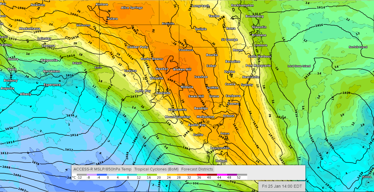
The weather responsible can be seen below via images from several global models showing the 850hPa temps where temps of around 30c can be seen over areas of most parts of SA and VIC for Thursday and Friday. These temps mean surface temps will be near the low to high 40’s.


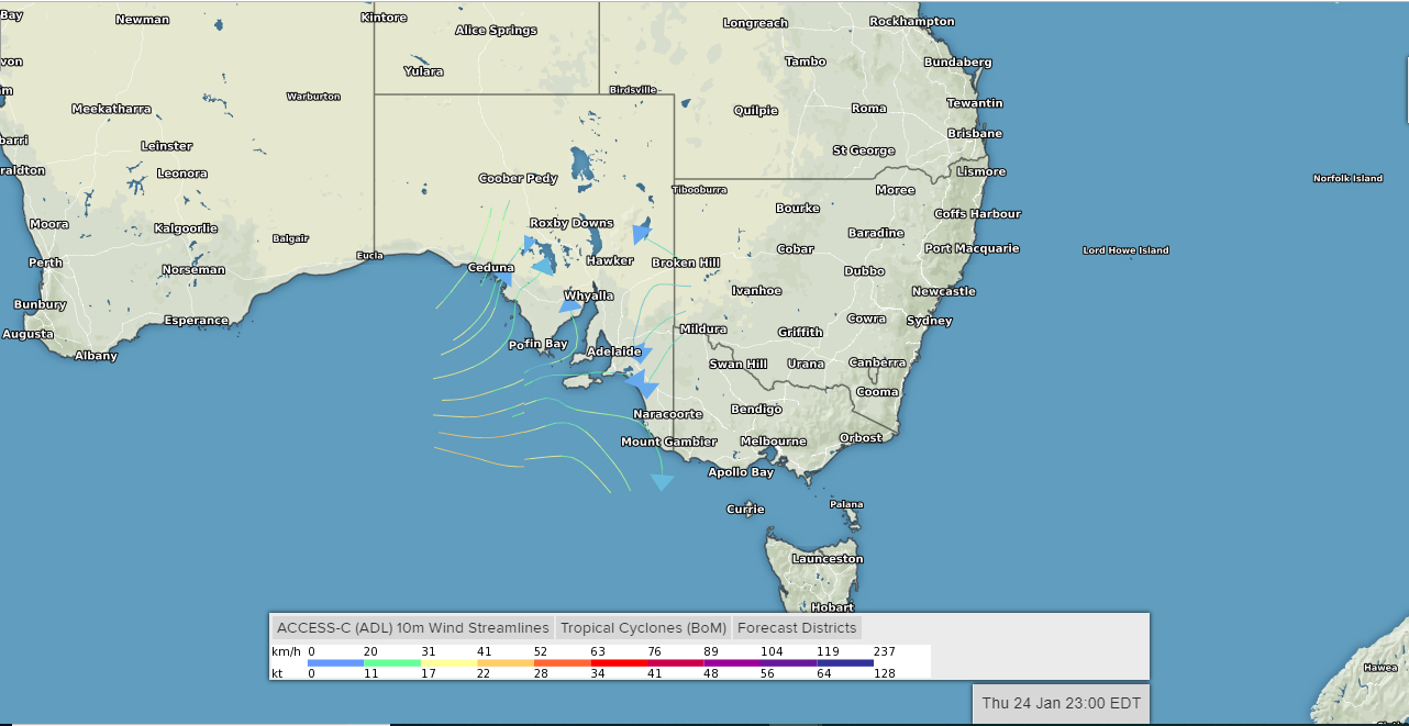
A cool change then will move into Adelaide and SA from late tomorrow night as seen below before moving into SW VIC early Friday morning. A VERY HOT day is forecast for Adelaide and SA with most locations likely to climb into the mid to high 40’s with Port Augusta going for a top of 49c and could hit 50c while Adelaide is going for a top of 45c while gusty winds will bring Severe to Extreme Fire Danger to areas on Thursday. All eyes will be on Port Augusta after Ceduna broke it’s all-time maximum temperature of 47.9c with 48.4c at 2:50pm on Wednesday.
The current record for Adelaide is 46.1c at West Terrace. While Port Augusta is forecast to break it’s all time record set back in 2011 of 47.9c with a top of 49c forecast and may even reach a feat few stations the bureau run reaching a official top of 50c. This is VERY RARE! and most certainly and commonly unofficial. A cool change however will impact as shown below by the ACCESS-C model by 11:30pm Thursday Night. The heat will then move into Victoria were it will all begin on Thursday as temperatures soar into the high 30 to low 40’s and then remain in the low 30’s to high 20’s right throughout Thursday Night into early Friday Morning, before gusty winds ahead of the change pick up and temperatures start to climb early into the early/late afternoon where most places will see temperatures into the mid to high 40’s except for coastal areas. Melbourne will likely challenge it overnight highest minimum record of all time of 30.6c despite the current minimum for Friday been 29c. Then challenge it’s maximum temperature of 46.4c on Friday. Albury in the VIC’s NE might also challenge for a new record despite setting a new one last week. Again gusty winds ahead of the cool change will spike fire danger to DANGEROUS levels of Severe to Extreme Dangers with a “CODE RED” not been ruled out being declared in one or two districts. With lead up conditions similar to that of Black Saturday Bushfires of 2009. Whether Friday will be the same conditions like that fatal day can’t be said till Friday.
So with that this Severe Heatwave looks to be a record breaker and setter, and we will continue to provide updated information as it comes to hand. So stay tuned to this article for updates over the coming days.