PERTH,WA-A Significant Winter Cold Front with a COLD AIR MASS will move up from the Southern Indian Ocean over the week and impact SW WA over Monday and Tuesday of August 1st-2nd next week to kick off the working with DANGEROUS WEATHER CONDITIONS with LOCALLY DESTRUCTIVE WINDS, DAMAGING WINDS and LARGE SURF, POSSIBLE SMALL HAIL, POSSIBLE SNOW on the Stirling Ranges and the ISOLATED brief risk of TORNADOES likely to be embedded in the leading edge and along the Cold Front.
NOTE: This is still 6-7 days out and is subject to change and carries a MEDUIM/MODERATE CONFIDENCE RATING.
Most Models are doing VERY WELL so far out in depicting a COLD FRONT to develop and cross the Southern Indian Ocean throughout the remainder of this week before impacting SW WA and the west coast at the start of next week on Monday, most likely in the late afternoon and evening. Before transitioning into a LOW/WINTER STORM before lashing the SW with DESTRUCTIVE WINDS, DAMAGING WINDS and POSSIBLE SMALL HAIL and the brief risk of ISOLATED TORNADO or TWO but A unstable COLD AIRMASS will bring a chilly day for many on Tuesday as it sets in, with the risk of sprinkle/dusting of snow on the high peaks of the Stirling ranges.
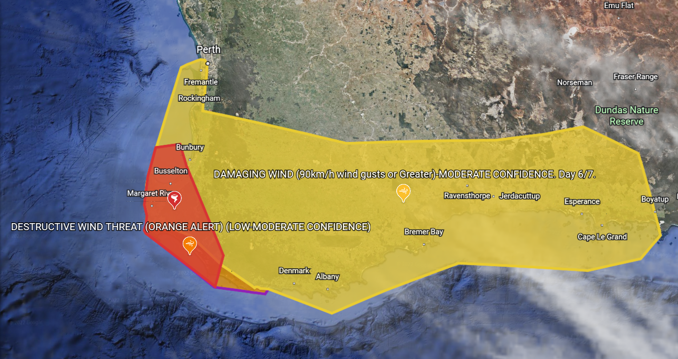
Below are some graphics of the current forecast and watches in place for the upcoming system:


More to come so stay tuned….