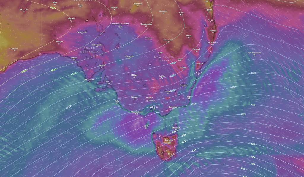
A developing low pressure and associated strong cold front is expected to bring some wild and severe weather across the SE of the country and Australia from later today and into Friday and Saturday.
A developing strong cold front and associated low pressure system in the Southern Ocean with the aid of a longwave trough will amplify the development of the low pressure and strong cold front to aid it to deepen as it crosses the Bass Strait. This will see a very cold damaging to locally destructive winds S’ly winds behind the front and on the western side of the low as the isobars tighten as a ridge of high pressure to the west also extends it’s influence. This will help to draw very cold temperatures and in combined with precipitation will see very wet, windy and cold few days ahead as the strongest winter system of the year impact SA, VIC, TAS, NSW/ACT and parts of QLD. While also producing low level snow and powerful to hazardous and damaging surf to south facing coastlines.

The most significant part of this system will be the damaging winds and potentially locally DESTRUCTIVE WIND GUSTS as this system peaks in the bass strait on Friday afternoon into the evening and early hours of Saturday Morning. This will start to make it’s presence felt later today on the SA coastline along the bight before extending inland and across SE Australia on Friday and Friday Night. Winds will be gusty to gale force on the coast of SA and gusty inland but depending the deepening and movement of the low this system will intensify as it crosses the bass strait and may extend damaging to LOCALLY DESTRUCTIVE winds along the Victorian coastline including parts of the SW Coast and Central Coast and maybe NW Tasmanian coast with wind GUSTS up to 120-130km possible with isolated gusts up to 140km/h not out of the question though most of these winds should remain over the open waters and away from land. However given the direction of the winds and lack of rainfall and dryness of the soil and dampness in other parts, trees not used to facing such winds will be of concern to topple and cause damage to property and homes in dense forest areas. As winds of 90-110km/h are possible especially through parts of VIC. Though direct damage to property and homes from the winds alone with the right preparation should be limited. As this system progresses the winds combined with snowfall over the Alpine region may cause blizzards and the winds may continue to be felt up the east coast to the ranges/divide west of Brisbane. However the widespread impact for winds will be contained to the SE and be most felt in SA, VIC and NSW. The winds should ease from Friday for SA and VIC, TAS and NSW/ACT on Saturday.

Along with winds this will be a great system for snow lovers with a lack of low level snow events of recent this sure will bring joy to those who have been waiting to see some white powdery snow outside the traditional alpine area. Snow is expected to fall across a good portion of SE Australia with 50-80cm expected across the Alpine region and the highlands of TAS, but outside that, this might be the first system to give a dusting to places like Ballarat, the Grampians, Dandenongs and Macedon Ranges in VIC and even the Flinders Ranges and Mount Lofty ranges in SA as snow is expected to fall down to 500-600m ASL in parts of SA and VIC and down to 200-300m in parts of TAS with isolated falls possible to 100m and even sea level can’t be ruled out.
However before you get to excited there are a few things to note, snow is subject to a few factors aligning, first their is precipitation at the time of the coldest air, then there is the freezing and thickness level is at a threshold for snow to fall at a certain height above sea level and temps being cold enough in the upper atmosphere mostly in the 850hpa level or 1500m 1.5km above your head. If all these align then there could be some very happy kids and people who usually don’t see snow waking up to a dusting, noting outside the Alpine region snowfall will be just be that “a dusting” so in the range of 0.1cm-1cm with isolated totals of up to 3cm.
Combined with winds in the Alpine region “Blizzard like conditions” are possible and so if thinking of travelling, it be best to leave that until the wind portion of the system has passed likely easing on Saturday Morning/Afternoon.

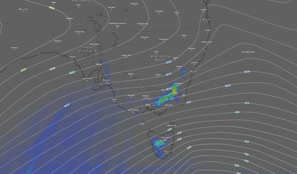
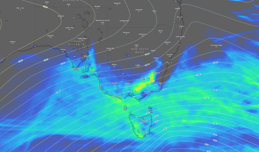
Rainfall wise not a lot is expected, but by no means is it not a healthy amount for a heavy drought affected region where it will be welcomed. Rain again will be highest in the Alpine region but much of that in the image below may fall as snow. However outside that parts of Adelaide and the Eyre Peninsula and Western and Southern parts of TAS will do well seeing rainfall of around 50mm+ While 15-20mm elsewhere and further inland 5-10mm is likely decreasing the further inland you go. Rainfall will come down to bands and may be hit and miss and if you get under a storm you may see more. Storms will be hit and miss and will bring Damaging Winds, Heavy Rainfall and small hail.
The last part of this is the surf/swell where on-shore winds where DAMAGING to POWERFUL SURF will cause slight inundation of coastal flooding and erosion especially on south facing coastlines of SA, VIC and TAS, especially during high tides, this may include locations in Port Phillip Bay and Western Port in VIC.
Apart from this the basic precautions are that are needed and while a elevated impact is expected, this is a typical weather pattern and system for this time of year but is the strength of such a system not see to often this far north, but is not expected to be the same intensity of the one a few years back which did significant damage.
