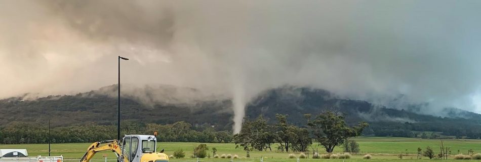
SIGNIFICANT WINTER STORM TO IMPACT SE AUSTRALIA THURSDAY to SATURDAY bringing DAMAGING WINDS, LOW LEVEL SNOWFALL, HEAVY RAINFALL and POWERFUL/HAZARDOUS SURF.

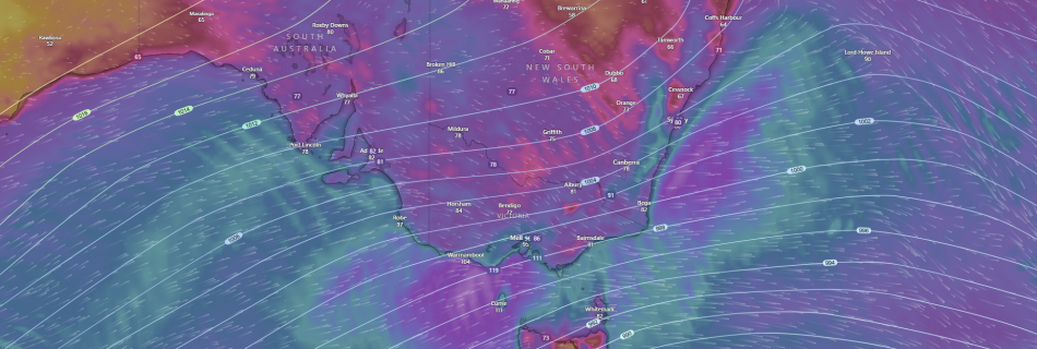
A developing low pressure and associated strong cold front is expected to bring some wild and severe weather across the SE of the country and Australia from later today and into Friday and Saturday. A developing strong cold front and associated low pressure system in the Southern Ocean with the aid of a longwave trough …

❄️LIANWENEE, TAS SMASHES IT’S JULY MINIMUM TEMPRATURE RECORD AND STATE RECORD FOR JULY❄️

Lianwenee, TAS breaks Minimum Temperature for 2nd straight night. Can it go for the all time state record? A building/blocking high pressure system the last few days that has been anchored/slow moving over the Southern Ocean near Tasmania on the west side has produced calm and stable conditions the last few nights and has left …

WESTERN AUSTRALIA: SIGNIFICANT COLD FRONT AND LOW TO HIT AROUND AUGUST 1st-2nd 2022.

PERTH,WA-A Significant Winter Cold Front with a COLD AIR MASS will move up from the Southern Indian Ocean over the week and impact SW WA over Monday and Tuesday of August 1st-2nd next week to kick off the working with DANGEROUS WEATHER CONDITIONS with LOCALLY DESTRUCTIVE WINDS, DAMAGING WINDS and LARGE SURF, POSSIBLE SMALL HAIL, …

REPORT: EF-1 Tornado strikes Woodend northwest of Melbourne, while at least 2 funnels are spotted in NE Victoria.

Woodend,VIC-On Thursday afternoon residents of Woodend on the foothills of the Macedon Ranges northwest of Melbourne, were given a surprise when a “freak” tornado carved a short but narrow path of damage along Mount Macedon Rd around 5:30pm. The Tornado that was short lived caused extensive damage to paddocks, sending haybales flying and uprooting and …