🌦️ TEST POST-SOCIAL INTEGRATION TEST/NEW WEATHER UPDATE

Testing our website publishing integration. THIS POST WILL BE “DELETED” AFTER RUNNING TESTS IN REGARDS TO FUTURE SOCIAL MEDIA/WEBSITE INTEGRATION OF THE PUBLISHING OF FUTURE WEATHER BLOGS ON THIS SITE.
🌦️ TEST POST-SOCIAL INTEGRATION TEST/NEW WEATHER UPDATE

Testing our website publishing integration. THIS POST WILL BE “DELETED” AFTER RUNNING TESTS IN REGARDS TO FUTURE SOCIAL MEDIA/WEBSITE INTEGRATION OF THE PUBLISHING OF FUTURE WEATHER BLOGS ON THIS SITE.

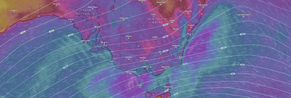
SIGNIFICANT WINTER STORM TO IMPACT SE AUSTRALIA THURSDAY to SATURDAY bringing DAMAGING WINDS, LOW LEVEL SNOWFALL, HEAVY RAINFALL and POWERFUL/HAZARDOUS SURF.

A developing low pressure and associated strong cold front is expected to bring some wild and severe weather across the SE of the country and Australia from later today and into Friday and Saturday. A developing strong cold front and associated low pressure system in the Southern Ocean with the aid of a longwave trough …

EXTREME WEATHER FORECASTING STATEMENT:

MELBOURNE, AUSTRALIA: Extreme Weather Forecasting is releasing this statement to advise it is thoroughly investigating the potential of a Tornado that hit between Stanhope and Shepperton in Victoria’s North after severe storms moved through the area yesterday afternoon. Further information or comments will be released once the investigation is complete. —MEDIA RELEASE ENDS—

WESTERN AUSTRALIA: SIGNIFICANT COLD FRONT AND LOW TO HIT AROUND AUGUST 1st-2nd 2022.

PERTH,WA-A Significant Winter Cold Front with a COLD AIR MASS will move up from the Southern Indian Ocean over the week and impact SW WA over Monday and Tuesday of August 1st-2nd next week to kick off the working with DANGEROUS WEATHER CONDITIONS with LOCALLY DESTRUCTIVE WINDS, DAMAGING WINDS and LARGE SURF, POSSIBLE SMALL HAIL, …