JUST RELEASED: BMOS Bulletin Quarter 2, 2020-June 2020 Edition.

JUST RELEASED: Volume 33 Issue 2 of The bulletin of the Australian Meteorological and Oceanographic Society Journal for Quarter 2 of 2020-June Edition has just been RELEASED!. With our very own Owner/Founder, CEO, Storm Researcher and Amateur Meteorologist Daniel Hayward co-authoring and making an appearance, in conjunction/partnership with the Bureau of Meteorology investigation team, who …

EXTREME & DANGEROUS HEATWAVE Shatters France National MAX Temperature Record!

Paris, France-A DEADLY & DANGEROUS week long heatwave is sweeping across Europe at the moment, with temperatures soaring well into the 40c+ range with some places touching just over 45c+ in parts of Southern France and NE Spain, which is just extrodinary and dangerous as FRANCE sets a ALL-TIME NEW MAXIMUM TEMPRATURE RECORD AND SEE’S …

EF1-EF2 TORNADO tears through the Lake Purrumbete Caravan Park in SW VIC CONFIRMED by EWF and the Bureau.

Lake Purrumbete, VIC: Last weeks wild weather saw numerous Severe Thunderstorms across much of SE Australia especially overnight Wednesday Night and Thursday Afternoon last week. In these storms were the risks of HEAVY RAINFALL, DAMAGING WINDS and LARGE HAILSTONES. However another severe weather phenomena seems to also have occurred last Wednesday Night in a possible …

LIVE BLOG: 40mm+ falls over parts of coastal South Australia as the Rain Event continues to unfold across Southeastern Australia.

Port Lincoln, SA-The Rain Event has hit parts of SA with over 40mm+ falling since 9am Tuesday Morning in Point Avoid, Cape Borda and Neptune Island SA. While Adelaide has seen rainfalls of around 6mm. Despite this a ROAD WEATHER ALERT was issued as bands of rains from a developing complex low pressure system continues …

Rain Event for SE AUS unfolding with 70-100mm+ possible for parts of VIC and decent falls for SA, NSW, TAS, including Severe Storms, Damaging Winds and Alpine Snow.

Melbourne, AUS: A rain event is about to unfold and lash parts of SE AUS over the next couple of days bringing HEAVY RAINFALL, DAMAGING WINDS and SEVERE THUNDERSTORMS. The event will start late tomorrow in parts of South Australia as a weak cold front starts to transition in to a complex low pressure system …

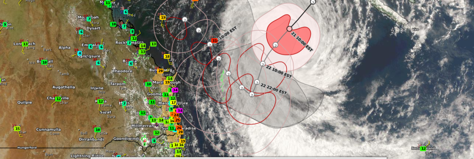
Tropical Cyclone WATCH issued for SE QLD and Far NE NSW for TC OMA for Tropical Storm Force/Strong Gale Force Winds as TC OMA continues SW track towards the SE QLD Coast.

BRISBANE, AUS-A Tropical Cyclone WATCH has been issued for people between Bundaberg and Ballina in far NE NSW for Strong Gale Force winds ahead of the approaching TC OMA (Category 2). Winds of 34kt are already occurring along the coast of the Wide Bay and Burnett District and SE QLD with Double Point Island and …

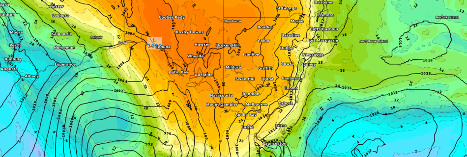
Severe Heatwave sets NEW Maximum Monthly Temperature Records and possible set others across parts of SA and VIC on Thursday and Friday this week!

ADELAIDE, AUS: A Severe heatwave currently impacting parts of WA and SA has set a new record in Ceduna since 1990. While it set to peak over the coming 48 hours as parts of SA and VIC will have there state January records and monthly and daily records challenged including minimum overnight records including Melbourne …

Women’s Santos Tour Down Under Forecast January 10th-13th 2019.

ADELAIDE, AUS-A new year and a new season of Cycling down under in Australia. The First Major event is the Women’s Santos Tour Down Under which will be contested by riders from around the world over 4 stages and 4 days. So with Stage 1 tomorrow and all pre-race interviews done and dusted let’s get …

OFFICIAL TABTOUCH PERTH CUP FORECAST FOR RACEDAY!!!

PERTH, WA, AUS-It’s OFFICIALLY the New Year and 2019 and that usually means today is the annual new year’s day tradition of the TabTouch Perth Cup held at Ascot Racecourse. This year it was and has been setback till Saturday 5th January 2019. Currently the Forecast is looking great for the MAIN EVENT R8 TABTOUCH …